Our service clearance provides clear, usable detail of services in the vicinity of the area in question and allows a safe area to excavate.
-
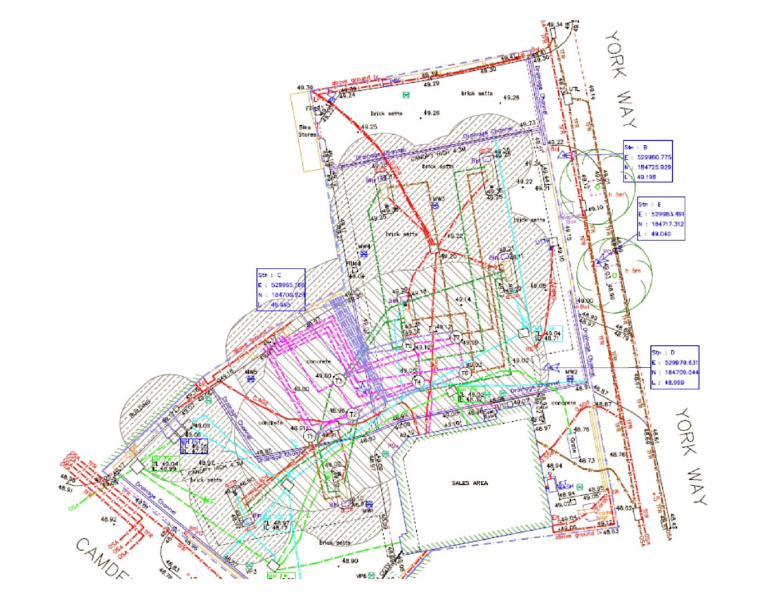
Utility maps pull together information collected from stat-plans into one easy to use topo drawing, and can comply with PAS128 where required.
-
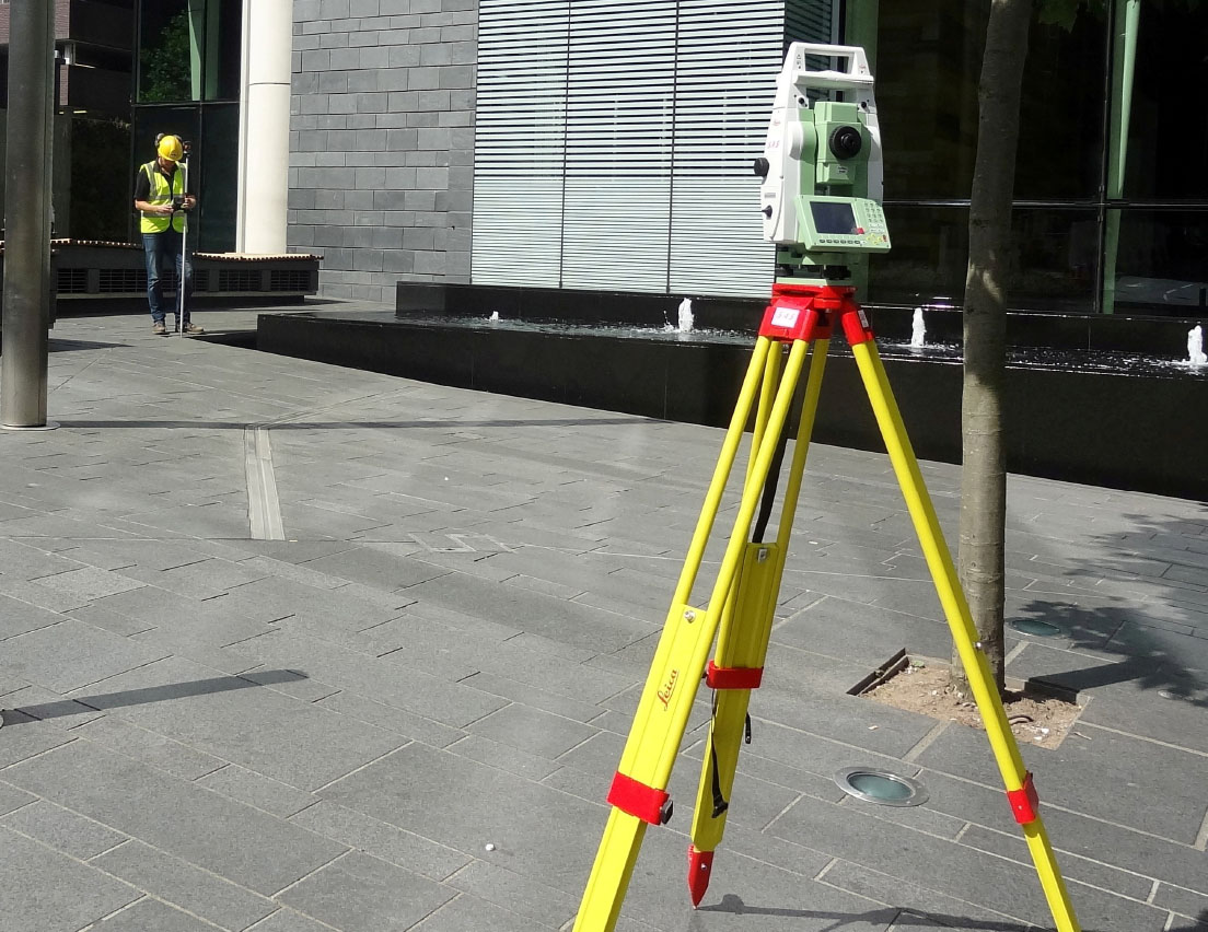
We can provide detailed topographical drawings, provision of OS grid and GPS co-ordinates, using state-of-the-art robotic equipment.